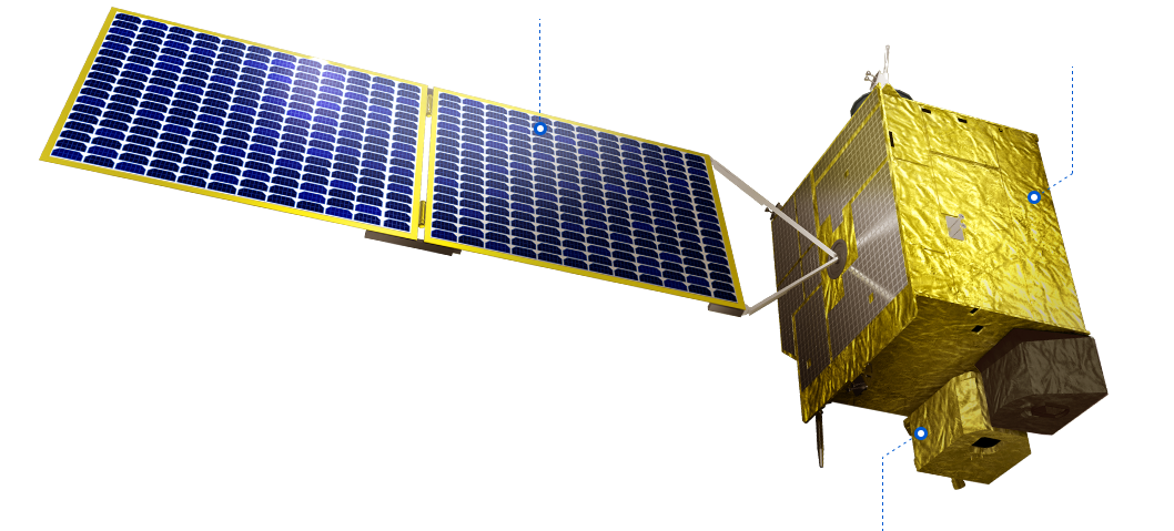
GEO-KOMPSAT-2B
 Solar Panel
Spacecraft
GOCI-II
GEO-KOMPSAT-2B (GK-2B) is a geostationary satellite mounted with the Geostationary Ocean Color Imager II (GOCI-II) for marine and environmental observation which always monitors the Korean Peninsula at the altitude of 36,000 km above the equator.
-
Local Area Coverage
+ Temporal Resolution 1 hour (UTC: 23:15 - 08:15) + Spatial Resolution 250 m x 250 m + Swath 2,500 km x 2,500 km -
Full Disk Coverage
+ Temporal Resolution 1 time / 1day + Spatial Resolution 250 m x 250 m
Spectral response function
Bands
| Band |
Wavelength(nm) | Bandwidth (nm) | Primary Use |
|---|---|---|---|
| B1 | 380 | 20 | CDOM(absorption of Colored Dissolved Organic Matter) |
| B2 | 412 | 20 | CDOM, chlorophyll |
| B3 | 443 | 20 | chlorophyll absorption maximum |
| B4 | 490 | 20 | chlorophyll, other pigments |
| B5 | 510 | 20 | chlorophyll, absorbing aerosol in oceanic waters |
| B6 | 555 | 20 | turbidity, suspended sediment |
| B7 | 620 | 20 | detect phytoplankton species |
| B8 | 660 | 20 | baseline of fluorescence signal, chlorophyll, suspended sediment |
| B9 | 680 | 10 | fluorescence signal |
| B10 | 709 | 10 | fluorescence base signal, atmospheric correction, suspended sediment |
| B11 | 745 | 20 | atmospheric correction, vegetation index |
| B12 | 865 | 40 | atmospheric correction, aerosol optical depth |
| B13 | wideband | 483 | star imaging for the INR (Image Navigation and Registration) performance |


